Finnish Earth observation data provider ICEYE has signed a contract with the United States Centers for Disease Control and Prevention to provide flood impact data and analysis.
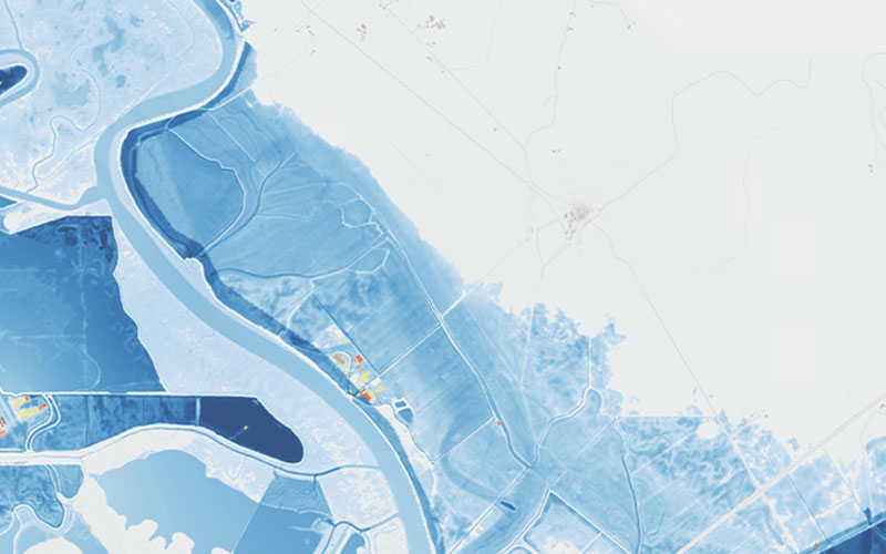
Founded in 2015, ICEYE provides satellite-powered disaster management solutions. The company’s Flood Insights product incorporates data from its constellation of over 30 Synthetic Aperture Radar (SAR) satellites and from third-party sources to deliver near real-time geospatial intelligence, including flood depth and building-level impact layers.
ICEYE announced on 3 April that it had signed a contract with the CDC. The company will provide flood impact data to the CDC’s Geospatial Research, Analysis, and Services Programme. According to ICEYE, the company will monitor all significant US flood events. The data collected will be used to enhance the CDC’s disaster response capabilities.
“Floods can devastate local communities and affect health and wellness outcomes long after the waters have receded,” explained Andy Read, ICEYE’s VP of Government Solutions. “ICEYE is proud to support CDC and our other global agency clients as they work to better understand and mitigate the impacts of flooding on public health.”
In early March 2024, ICEYE launched an additional three SAR satellites aboard a SpaceX Falcon 9 rideshare mission. The company has successfully deployed 34 spacecraft into orbit since 2018 on its way to building the world’s largest constellation of SAR satellites. It plans to launch up to 15 satellites in 2024 to continue the growth of its constellation and its offering.
Keep European Spaceflight Independent
Your donation will help European Spaceflight to continue digging into the stories others miss. Every euro keeps our reporting alive.


