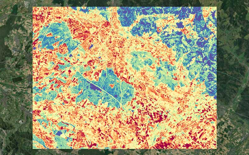
On 9 December, German Earth observation data provider constellr announced a multi-year contract with the German Aerospace Agency (DLR) to supply high-resolution thermal data. Dr. Max Gulde, CEO of constellr, shares insights into this partnership and highlights what makes the company’s offering unique.
Can you elaborate on the specific objectives of the partnership with DLR and how it aligns with constellr’s broader mission?
Dr. Gulde: constellr’s purpose is to support climate resilience and food security. Thermal data is a window into understanding the Earth itself, with a myriad of applications ranging from tracking crop transpiration to detecting underwater pollution events. constellr’s thermal data is the first ever high resolution, high accuracy dataset and thus is of tremendous importance for researchers to explore its potential. The goal of the partnership is to empower scientific researchers across Germany to gain a deeper understanding of the biophysical realities of our world. It supports our broader missions to enable smarter decisions for climate action, resource use, and global food security through actionable thermal intelligence.
How will the thermal data provided to the German Earth Observation research community be accessed and utilized? Will there be any restrictions or priorities in data distribution?
Researchers can apply to the German Space Agency through their platform to monitor specific areas or use the areas selected by the space agency itself. constellr will monitor these specific areas of interest with their own satellites and make the data available to the researchers through DLR’s platform.
What unique technologies or innovations are constellr’s satellites equipped with?
Our proprietary thermal-imaging satellite tech is designed to provide near-real-time temperature mapping across the planet. Our proprietary thermal infrared (TIR) and multispectral VNIR sensors are utilized to provide land surface temperature at 30m native resolution, daily revisit time, and a very high absolute temperature accuracy. The focus is on precision. This represents a significant advancement over the resolutions currently available from existing public missions conducting thermal infrared imaging, which offer daily images only at resolutions on kilometre scales. In 2022, this pioneering technology was tested aboard the International Space Station (ISS), where it successfully captured over 10 million images.
How does this agreement position constellr within the competitive Earth Observation market, and what does it mean for the future of thermal imaging technology?
Our technology provides a meaningful improvement in resolution over existing solutions. This is critical – the higher the resolution, the greater the insights we can take from them. The German Space Agency’s decision to partner with us highlights how scientific researchers are gravitating toward the EO solutions with the highest level of detail, and the vital role of thermal imaging technology in solving national and global challenges.
Can you share examples of research projects where this data could make a significant difference, particularly in addressing issues like food security or climate change?
Of course. In agriculture, thermal intelligence can provide invaluable insights into crop health, soil moisture levels, and early indicators of disease or drought. Farmers require early warning insights into crop development to allow them to take preventative action to protect yields. Stressed plants show subtle symptoms, invisible to the naked eye but detectable through temperature changes. By the time the plants exhibit symptoms detectable by in-field sensors and visual information, it’s too late – the yield has been irretrievably damaged. By detecting changes in plant transpiration through leaf temperature analysis, thermal satellites can identify crop stress up to two weeks before visible symptoms appear. This early warning system allows for timely intervention to protect yields and even extends to pest detection.
With far more than 50% of the world’s population living in cities, urban heat is a growing global problem, costing lives and affecting economic output. constellr’s land surface temperature can be used to identify heat islands on a building or street level resolution, tracking and monitoring climate adaptation measures throughout the seasons and thus enable more sustainable and resilient urban development. Researchers can analyse all of this also in relation to the actual thermal comfort of the cities’ inhabitants, explore the relation of land surface temperature to the health of urban greens, and the applicability of satellite data for day-to-day city administration tasks.
How closely will constellr collaborate with DLR and other German research institutions during the course of this multi-year agreement? Are there plans for joint research initiatives?
An important part of the contract is scientific collaboration. Any team that uses our data will have the possibility to work with us and receive scientific support. It is intended to build a network of researchers that work with thermal data and build synergies.
What challenges do you anticipate in delivering this data, and how is constellr preparing to address them?
Demand for our data is very high both on the scientific and on the commercial side. So, we do anticipate that our satellites will run at full capacity in the coming three years. Our main challenge will be to grow our capacity at the required speed.
You plan to begin deploying your HIVE constellation next year. How many satellites will be launched in 2025?
We are expecting to launch two satellites in 2025.
How many satellites will you need to launch to begin providing data from the HIVE constellation and when are you expecting that to occur?
Just one! Each satellite provides impressive thermal data to a high degree of accuracy. As soon as our first satellite is in orbit, we will have access to a steady stream of data. As we launch further satellites, we can hasten revisit rates, with the goal of providing near-real-time intelligence and daily revisit rates upon completion of the constellation. Our first launch will be next year.
What is the total number of satellites that will be launched to complete the constellation?
That number depends on the capacity required to fulfill the demand. Our first objective is a constellation of five satellites. This will allow for daily measurements anywhere on Earth.
Beyond this partnership, are there plans to expand similar collaborations with other space agencies or international organisations?
Space exploration is a collaborative industry, and we’d be delighted to work with other space agencies or international organisations. Securing these partnerships has long been one of our key objectives. For example, we secured a multi-million contract with the European Space Agency in 2023, to provide high-resolution images from space for the Copernicus Earth Observation Programme as a Copernicus Contributing Mission.


